Capabilities
Saikei Civil provides production-ready infrastructure design capabilities built on IFC 4.3 and Blender.
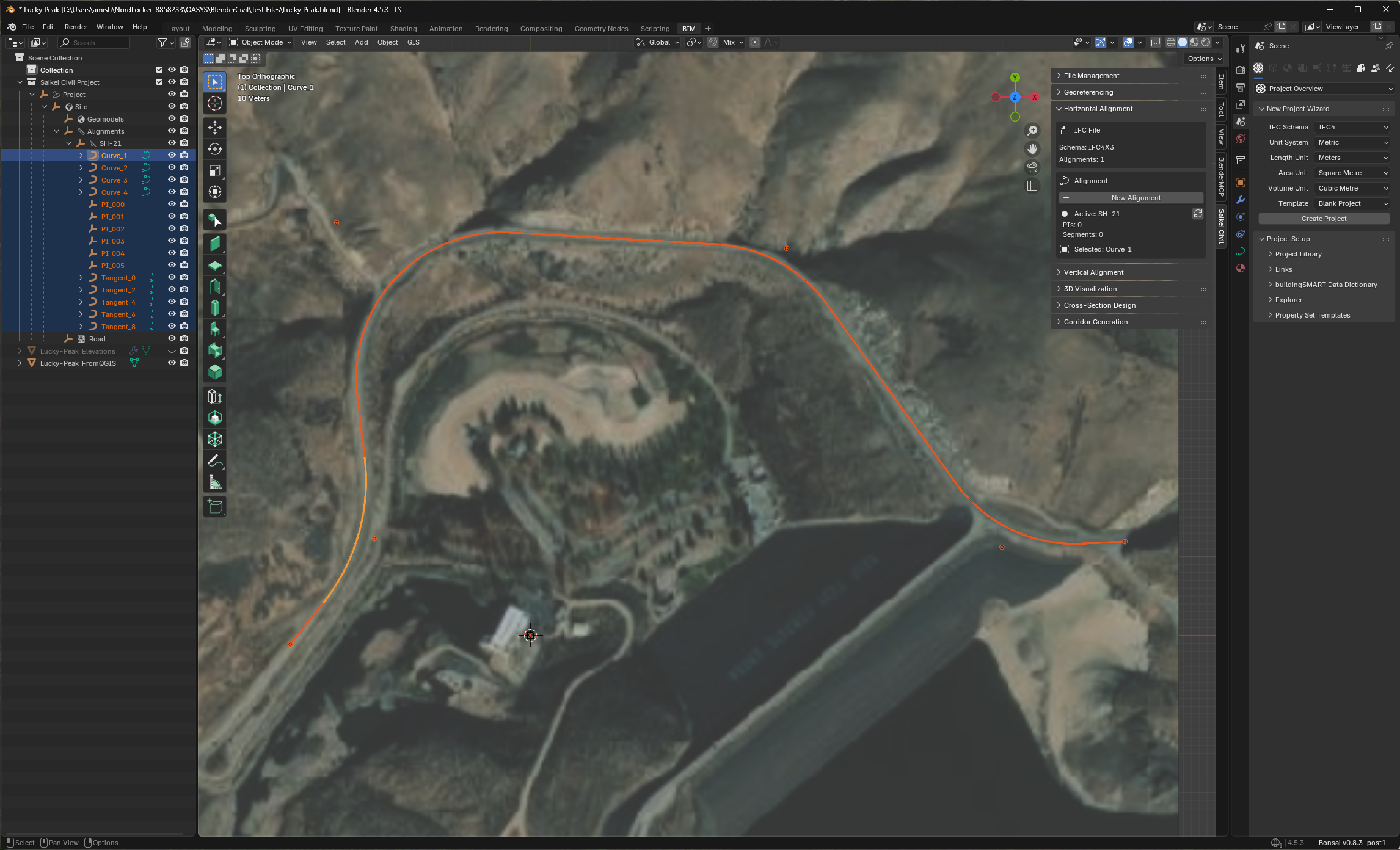
Horizontal Alignments
Design road centerlines using industry-standard PI (Point of Intersection) methodology.
| Feature | Description |
|---|---|
| PI-Based Design | Define alignments through control points with automatic tangent generation |
| Curve Geometry | Circular curves with configurable radii |
| Station Equations | Full stationing support with equation handling |
| Real-Time Preview | Immediate visualization as parameters change |
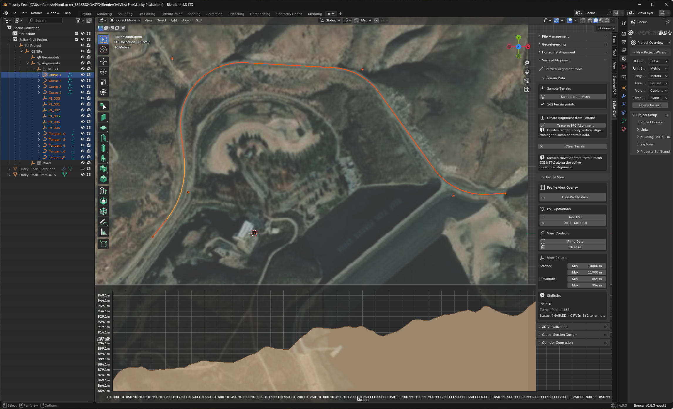
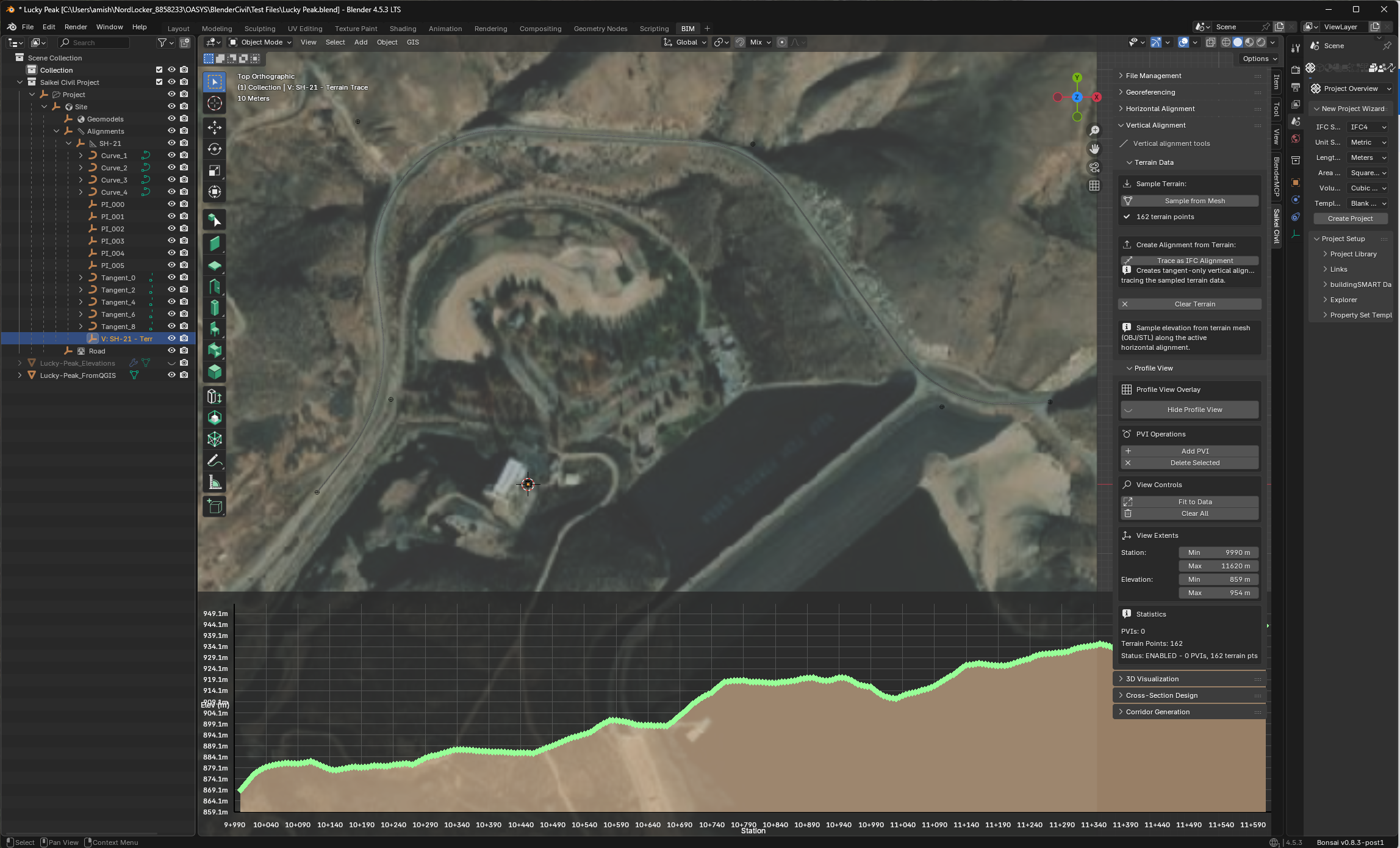
Vertical Profiles
Create vertical alignments with grade-compliant vertical curves.
| Feature | Description |
|---|---|
| PVI-Based Design | Vertical curves defined through Points of Vertical Intersection |
| Parabolic Curves | AASHTO-compliant symmetric and asymmetric curves |
| Grade Calculations | Automatic grade percentage computation |
| Terrain Tracing | Sample elevations directly from terrain mesh |
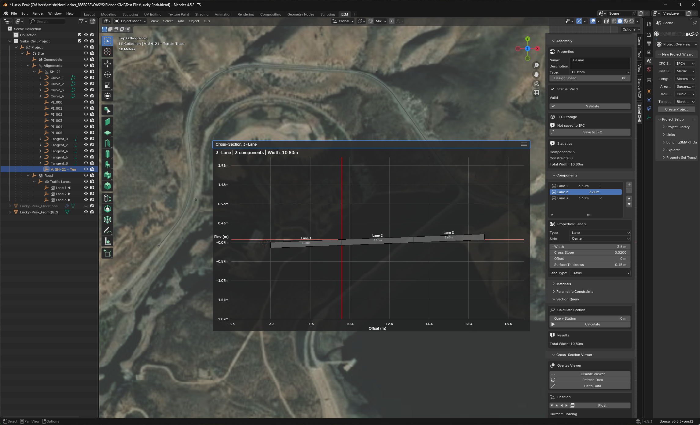
Cross-Section Templates
Define roadway typical sections with parametric components.
| Feature | Description |
|---|---|
| AASHTO Templates | Pre-configured lane and shoulder widths |
| Parametric Lanes | Adjustable travel lanes with crown slopes |
| Shoulders | Inside and outside shoulders with independent slopes |
| Side Slopes | Cut and fill slope definitions |
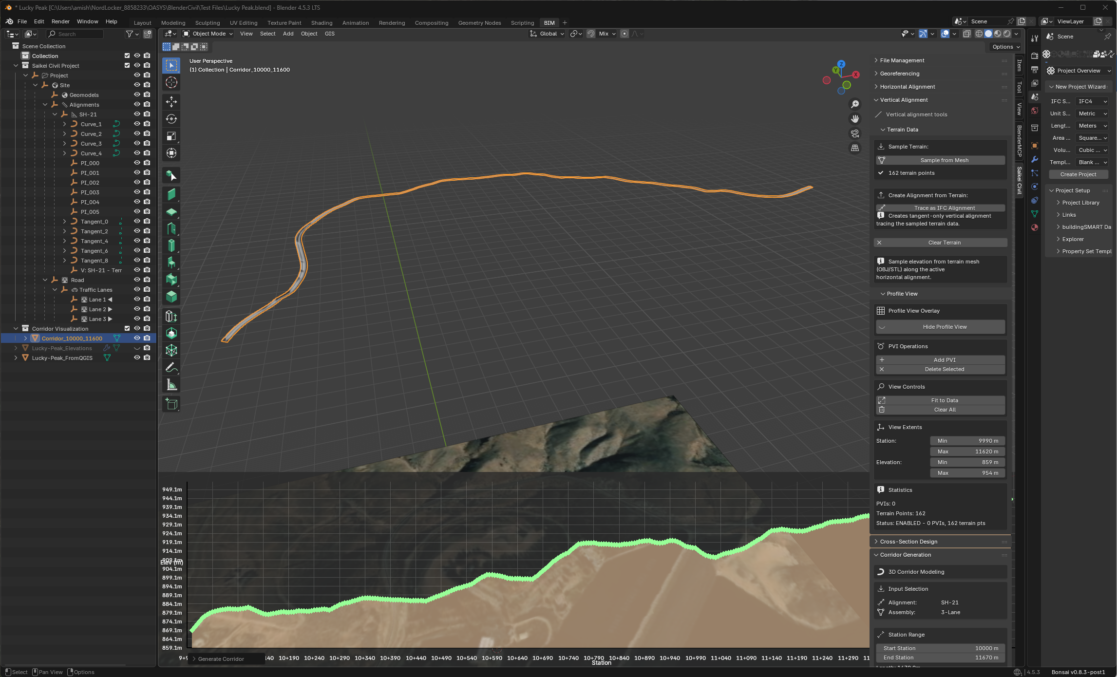
Corridor Modeling
Generate 3D roadway corridors by combining alignments, profiles, and cross-sections.
| Feature | Description |
|---|---|
| 3D Mesh Generation | Complete corridor surfaces from design data |
| Station Range Selection | Define corridor extents by station |
| Profile View Overlay | Simultaneous plan and profile visualization |
| Terrain Integration | Corridors follow existing ground |
Georeferencing
Accurate real-world positioning through coordinate reference systems.
| Feature | Description |
|---|---|
| CRS Integration | PyProj-powered coordinate system support |
| EPSG Codes | Standard coordinate reference system identifiers |
| Sub-Millimeter Precision | Validated accuracy for survey-grade positioning |
| Coordinate Transforms | Project-to-global and global-to-project conversions |
Native IFC 4.3 Support
Saikei Civil creates IFC 4.3 files as its native format—not as an export conversion. Infrastructure designs are IFC from initial creation, ensuring data integrity throughout the project lifecycle.
Supported IFC Entities
| Entity | Implementation |
|---|---|
| IfcAlignment | Complete alignment container with horizontal and vertical components |
| IfcAlignmentHorizontal | Line and circular arc segments |
| IfcAlignmentVertical | Constant gradient and parabolic arc segments |
| IfcAlignmentSegment | Individual segment definitions with transition geometry |
| IfcCompositeCurve | Geometric representation of alignment paths |
| IfcMapConversion | Georeferencing with coordinate system transformations |
| IfcProjectedCRS | EPSG-based coordinate reference system definitions |
Standards Compliance
- Built on IfcOpenShell, the open-source IFC toolkit
- Targets IFC 4.3 (ISO 16739-1:2024) infrastructure schema
- Output validated against IFC structure requirements
- Designed for interoperability with buildingSMART-certified applications
View Architecture Documentation
Demonstration Project
Lucky Peak Dam Access Road — Boise, Idaho
A demonstration project showcasing Saikei Civil’s alignment and cross-section capabilities for rural road infrastructure.
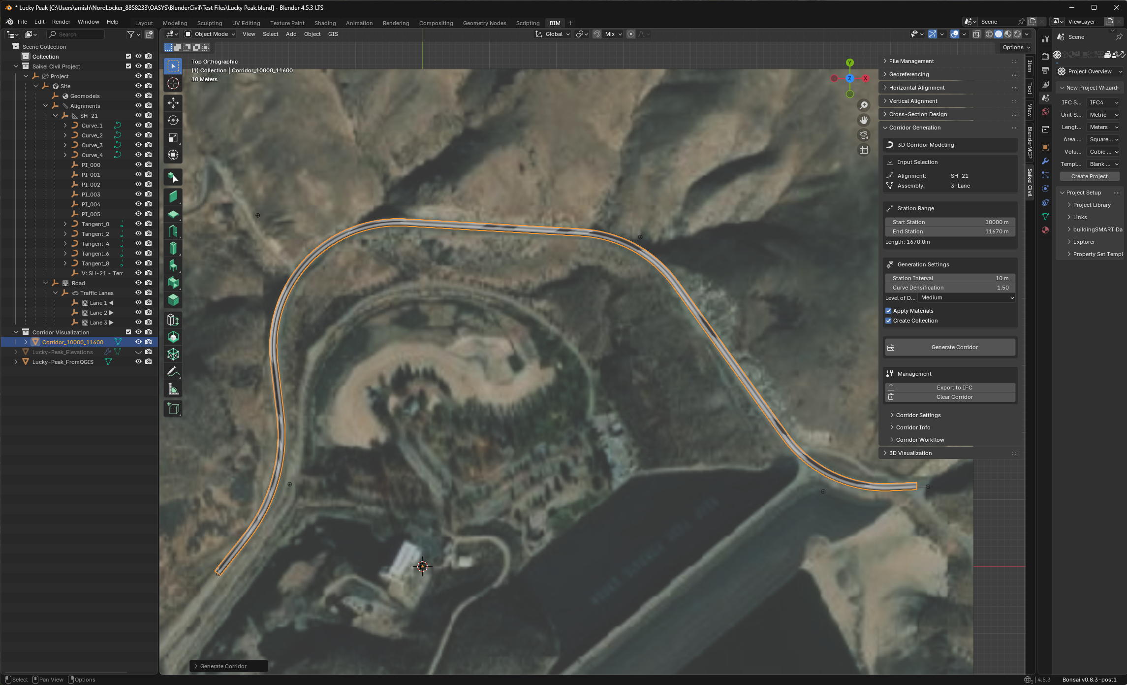
Scope:
- 1.0 km horizontal alignment with compound curves
- Vertical profile with 4% maximum grade
- Rural road cross-section (24’ travel way, 4’ shoulders)
- Geolocated to Idaho State Plane coordinates
Get Started
Download Saikei Civil and explore these capabilities in your own projects.